Mackinac Island State Park
Mackinac Island State Park was first established as Mackinac National Park in
1875, which was the second national park established in the United States after
Yellowstone National Park. In 1895, it was transferred to state control and was
the first state park.
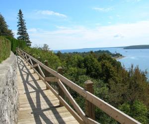
The island park encompasses 2.81 mi2 (7.28 km2), which is approximately 74% of
the island's total area of 3.78 mi2 (9.78 km2). The park is also within the
boundaries of the city of Mackinac Island and has permanent residents within its
boundaries.
M-185 circles the perimeter of the park as the only motorless highway in the
state due to the island's ban of automobiles.
Mackinac Island played an important role in the War of 1812 between the United
States and Canada (then a British colony).
Fort Mackinac, upon the island, was built by the British army during the
Revolutionary War. The British later relinquished the fort to the Americans in
1796, but then built and maintained a similar fort on nearby St. Joseph Island.
Location
7029 Huron Rd
Mackinac Island
Michigan,
USA
Getting There
Mackinac Island State Park is located on Mackinac Island in Michigan and is only
accessible by ferry or boat as there are no cars allowed on the island.
To get to Mackinac Island, you can take a ferry from several ports on the
mainland, including Mackinaw City and St. Ignace. From there, you can take a
horse-drawn carriage or rent a bike to explore the island and get to Mackinac
Island State Park.
If you are traveling from other parts of Michigan, you can take a bus or drive
to Mackinaw City or St. Ignace and park your car in one of the designated
parking lots before taking the ferry to Mackinac Island.
Nearby Airports
This is a list of primary airports in Michigan that have scheduled passenger service on commercial airlines.
undo Major Attractions in Michigan